
Summary
- In the framework of the LERC project (Landscapes of Early Roman Colonization project: Stek & Pelgrom 2013; Pelgrom et al. 2014), 32.69 sq km of the territory of Venosa (PZ - Basilicata) and its surrounding municipalities have been systematically surveyed in the falls 2013 to 2017. The LERC survey worked with teams of five field walkers spaced ten meters apart in parallel lines in each field unit (20% coverage), and set a shard density threshold of five archaeological fragments per square meter to identify significant material scatters and establish the contours of these surface concentrations (notionally, "sites"). These material scatters were mapped in the field by means of GPS positioning systems and mobile devices (i.e. tablets), and in the laboratory they were integrated through the GIS platform. The LERC fieldwork in Venosa was coordinated by Dr. Jeremia Pelgrom (Field project Director - KNIR), in collaboration with Dr. Tesse D. Stek (Leiden University), Dr. Jesús García Sánchez (Leiden University), Dr. Anita Casarotto (Leiden University), and Prof. Maria Luisa Marchi (University of Foggia). ............................................................................................................................. Please cite this Record as: Pelgrom, J., Casarotto, A., García Sánchez, J. & Stek, T.D. 2019. Landscapes of Early Roman Colonization Project – Venusia survey [data-set]. Fasti Online Survey [distributor]. Permalink: http://www.fastionline.org/survey/site/AIAC_436
Project Dates
- 2013 - 2017
Periods
- No period data has been added yet
- 900 BC
- 350 BC
- 1 BC
Survey Method
![[ed]](/survey/skins/fastisur/images/plusminus/edit.png "Edit")
![[view]](/survey/skins/fastisur/images/plusminus/view.png "View")
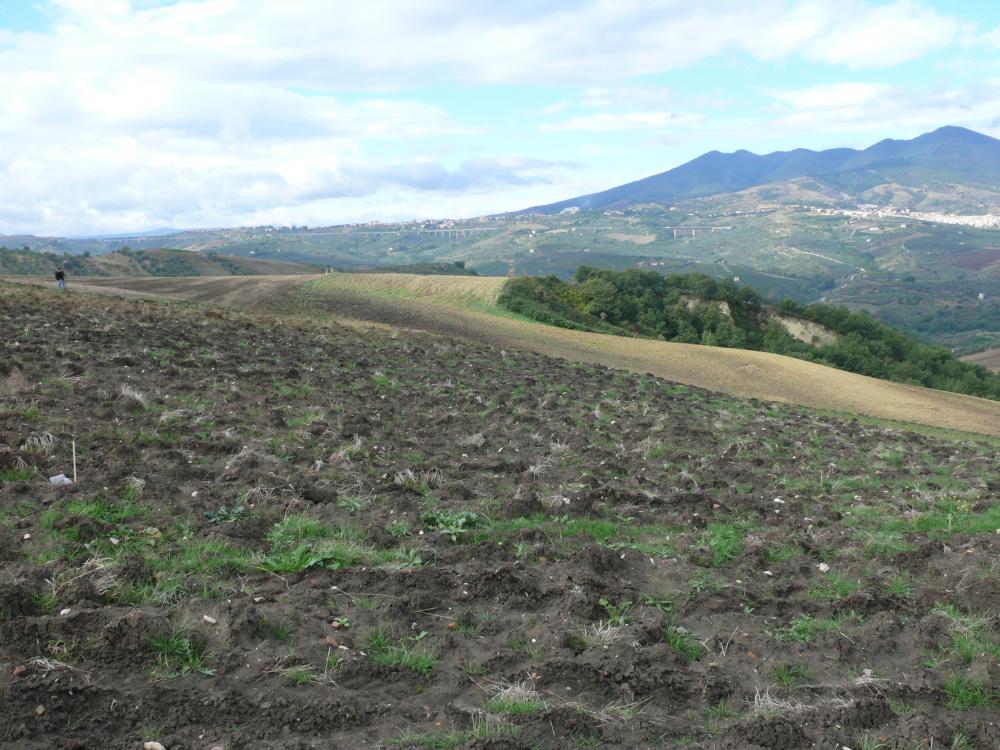
- Fields were first surveyed using a systematic line-walking strategy with ten meters intervals between field walkers. The position and size of surface material scatters with five or more fragments per sq m were recorded in each field unit. Only Black Gloss pottery fragments were collected from the field units. The precise position of every single fragment of Black Gloss pottery was recorded using the GPS. Secondly the identified material scatters were resurveyed in a random manner to collect as many Black Gloss fragments as possible. The position of these pottery shards was recorded as well using the GPS. In few localized zones within the survey area the LERC team adopted also an intensive survey strategy with total collection in each unit of all archaeological material. Unit forms were used to register in each surveyed unit the archaeological information, modern land use, geomorphological and visibility conditions (on a scale from 1 (low) to 5 (high)).
Research Focus
Other Comments
- Field Director: Jeremia Pelgrom (Royal Netherlands Institute in Rome). Project Director: Tesse D. Stek (Leiden University)
- The LERC team aimed to verify the reliability of the large-scale clustered pattern documented by the legacy Hellenistic settlement distribution registered by previous surveys in this area (namely by the Venusia - Forma Italiae project - Marchi & Sabbatini 1996, and the Ager Venusinus I and II - Forma Italiae project - Sabbatini 2001, Marchi 2010 (discussion in Casarotto, Pelgrom & Stek 2016; García Sánchez, Pelgrom & Stek 2017). The LERC survey shed light on the role of large nucleated rural settlements in the early Roman colonial period (3rd century BC) (Pelgrom et al. 2014; Pelgrom et al. 2016).
Funding Body
- Netherlands Organization for Scientific Research (NWO); Leiden University; Royal Netherlands Institute in Rome (KNIR).
Research Institution
- Faculty of Archaeology, Leiden University; Royal Netherlands Institute in Rome (KNIR).
Director
-
Director
- Jeremia Pelgrom - Royal Netherlands Institute in Rome (KNIR)
![[PDF]](download.php?file=7390.jpg "Download")
![[PDF]](download.php?file=7391.jpg "Download")

![[PDF]](download.php?file=7392.jpg "Download")

![[PDF]](download.php?file=7393.jpg "Download")

![[PDF]](/survey/skins/fastisur/images/results/download_sml.png "Download")