
Summary
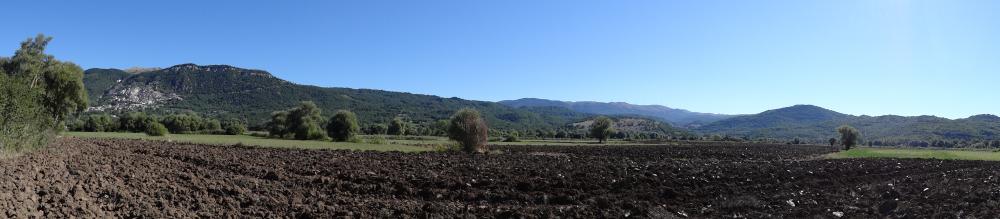
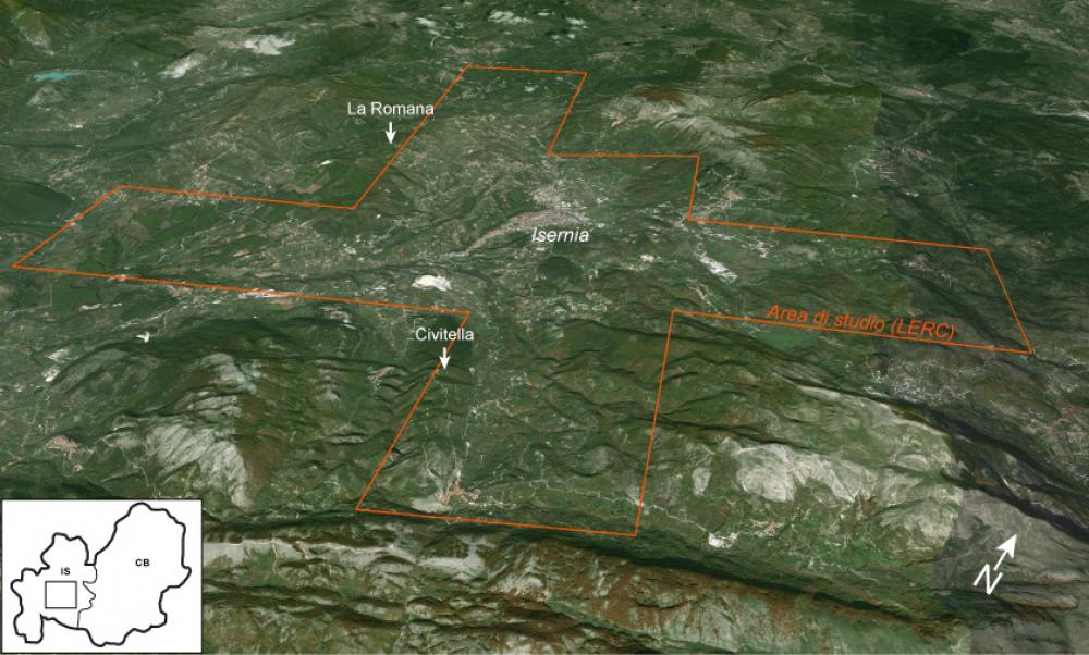
- The character of Roman colonization and its consequent impact on the conquered areas of Italy and beyond have recently become the subject of an intense and dynamic scholarly debate. Understanding the nature of Roman colonization in the mid-Republican period (ca. late 4th-2nd centuries BC) is particularly critical, because the establishment of colonies is thought to have been a key factor in Roman expansionist and imperialist strategies developing in that period. Recent studies have criticized traditional views of Roman colonies, and the possibility that the mid-Republican colonial settlements differed intrinsically from the colonies established in the late Republican and Imperial periods has come into view. The debate so far has mainly focused on the primary urban centers that are associated with the colonies. However, it has become clear that understanding the colonial settlement organization as a whole, including both the central settlement and the wider territory, is fundamental for assessing traditional and new hypotheses on Roman colonization and its impact on the wider environment and local society. With a view to contribute to this debate, in 2011 we started a large-scale landscape archaeological project in the territory of the colony of Aesernia, located in the modern province of Isernia, Molise, in Central-Southern Italy. According to the literary sources, Aesernia, a colony of the so-called Latin right, was established by Rome in 263 BC in mountainous territory that Roman armies had conquered from the Samnites during the Samnite-Roman conflicts. The case of the colony of Aesernia is especially relevant in current discussions about the character and impact of Roman colonies, precisely because it was established within what has traditionally been seen as a fundamentally different, non-urbanized society and settlement reality than that commonly associated with Roman colonies, and Graeco-Roman civilization in general. Tracking and understanding the behavior of early Roman settlers in this particular area may therefore yield important insights into the socio-political set-up of Roman colonies, the economic basis of the colonial community, and Roman colonial ideologies and attitudes towards settlement and landscape. Also, the longer-term developments in the landscape surrounding the settlement of Aesernia throughout the Republican, Imperial and late Roman periods allow us to follow the functioning and development of an Italic-Roman town over time. Tesse D. Stek (excerpt from Stek, T.D. et al. 2015, ‘An early Roman colonial landscape in the Apennine mountains: landscape archaeological research in the territory of Aesernia (Central-Southern Italy)’, in Analysis Archaeologica 1, pp. 229-230) ............................................................................................................................. Please cite this Record as: Stek, T.D., Pelgrom, J. & Kalkers R.A.A. 2019. Landscapes of Early Roman Colonization Project – Aesernia survey [data-set]. Fasti Online Survey [distributor]. Permalink: http://www.fastionline.org/survey/site/AIAC_444
Project Dates
- 2011 - present
Periods
- No period data has been added yet
- 4900 BC
- 3500 BC
- 1900 AD
Survey Method
![[ed]](/survey/skins/fastisur/images/plusminus/edit.png "Edit")
![[view]](/survey/skins/fastisur/images/plusminus/view.png "View")
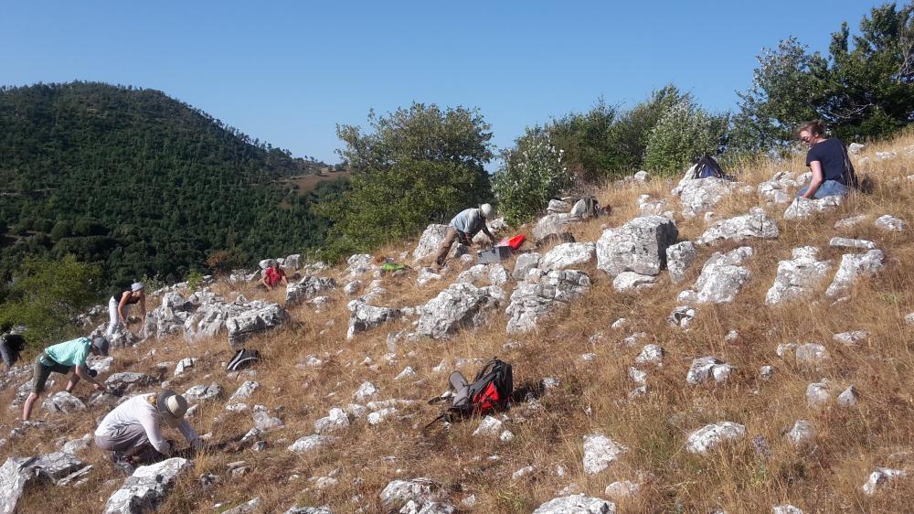
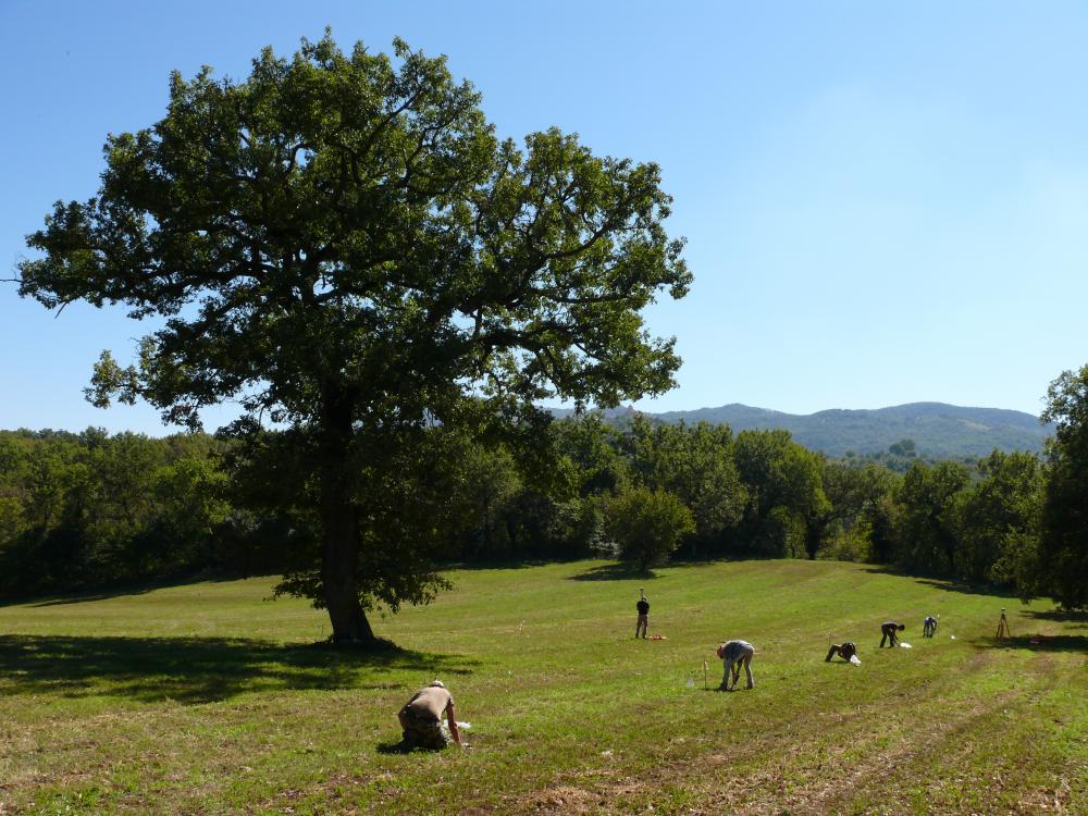
- Intensive, systematic, diachronic, site-oriented survey. As a methodological check, part of the survey area has been re-surveyed using an intensive, systematic, diachronic, off-site approach. Also, in intensive, systematic intra-site survey has been carried out on selected sites. Full coverage sampling of all accessible land in the survey area; survey units were sampled at 10 m. field walker spacing. Selective collection (standard 20% sampling from site contexts) + diagnostic collection. Units (corresponding to modern field boundaries; sometimes split in smaller units for improved resolution) + point samples / gridded units for intra-site survey. Handheld devices / tablets equipped with internal GPS and GIS software (first ESRI ArcPad, later QGIS for Android), using satellite imagery and the 1:5000 topographical map (Carta Tecnica Regionale).
Research Focus
Other Comments
- Project staff: Director: Tesse D. Stek Co-director: Jeremia Pelgrom Project assistant: Rogier A.A. Kalkers Post-doctoral researchers: Gianluca Cantoro, Jesús García Sánchez, Emily B. Modrall, Marleen K. Termeer Ph.D. researchers: Anita Casarotto, Arthur C. Hamel Affiliated researchers: Sheila Cherubini, Helga di Giuseppe, Lisa Götz, Luigi Pinchetti, Filippo Salamone, Apostolos Sarris, Jan Sevink, Ruud van Otterloo Field / lab team leaders: Martine Becx, Frank Beijaard, Russ Biggs, Max Caspers, Stefan Kooi, Lennart Kruijer, Tijm Lanjouw, Koos Mol, Pim Ofman, Jacqueline Splinter
- What was the nature of (early) Roman colonial settlement organization? What was the socio-political set-up of such a colony? What was the economic basis of the colonial community? What were the Roman colonial attitudes towards settlement and landscape? How does the (esp. nucleated) settlement organization change over time, throughout the Republican, Imperial and late Antique periods?
Funding Body
- The Netherlands Organisation for Scientific Research (2012-2018); European Union, Marie Curie Fellowships (2011-2012)
Research Institution
- Leiden University, Faculty of Archaeology (2012-present); The Royal Netherlands Institute in Rome (2012-present); Glasgow University, Department of Archaeology (2011-2012)
Director
-
Director
- Tesse D. Stek - Faculty of Archaeology, Leiden University
- Jeremia Pelgrom - Royal Netherlands Institute in Rome (KNIR)
![[PDF]](download.php?file=8060.jpg "Download")
![[PDF]](download.php?file=8061.jpg "Download")
![[PDF]](download.php?file=8062.jpg "Download")
![[PDF]](download.php?file=8063.jpg "Download")
![[PDF]](download.php?file=8064.jpg "Download")