


Monuments
Periods
- No period data has been added yet
Season
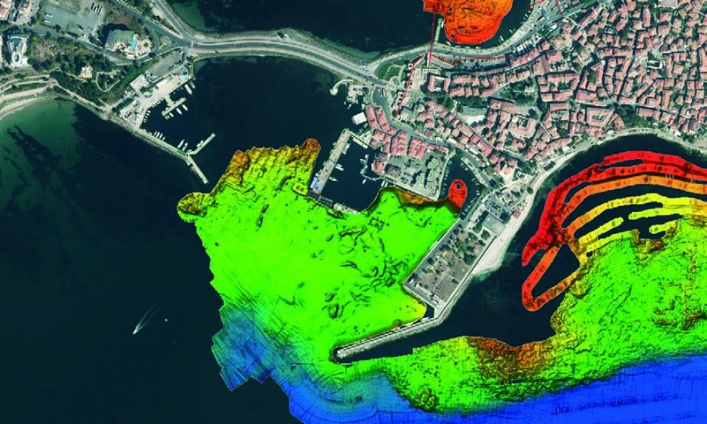
- UNDERWATER ARCHAEOLOGICAL SURVEY IN THE SOUTHERN HARBOR OF MESAMBRIA (Nayden Prahov – naydenprahov@yahoo.com, Kalin Dimitrov) The area for the dredging works, which was explored, was c. 400 m long and c. 100 m wide. The harbor was from 6 m to 9 m deep. Div... Read More
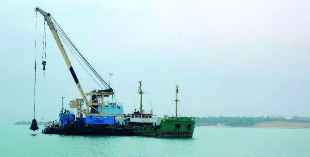
- UNDERWATER ARCHAEOLOGICAL OBSERVATIONS IN THE SOUTHERN HARBOR OF MESAMBRIA (Nayden Prahov – naydenprahov@yahoo.com, Kalin Dimitrov, Todor Marvakov) The dredging works in southern harbor, carried out by a floating crane Giant, were observed. The dredging ar... Read More
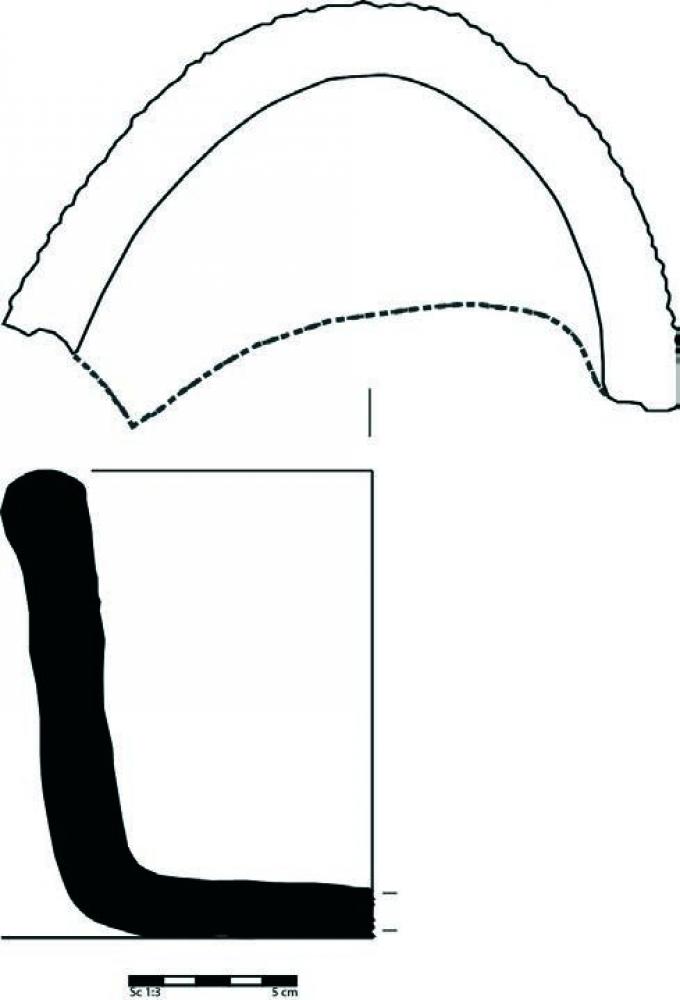
- UNDERWATER ARCHAEOLOGICAL EXPLORATIONS IN THE AQUATORY OF MESAMBRIA (Nayden Prahov – naydenprahov@yahoo.com, Kalin Dimitrov) Fifteen underwater archaeological expeditions were carried out between 1960 and 1984. Fortification structures were discovered to t... Read More
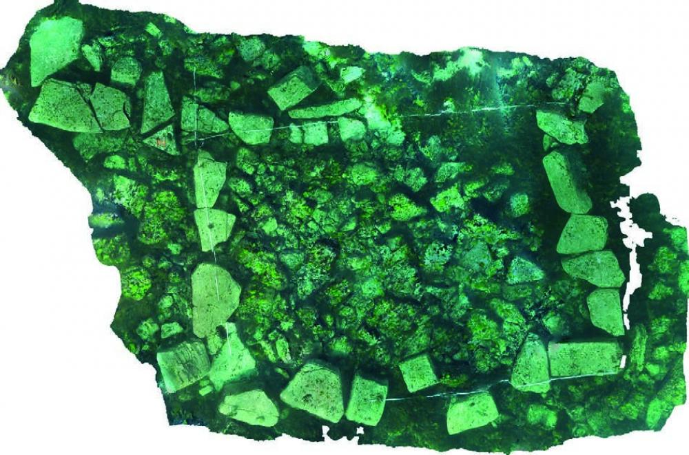
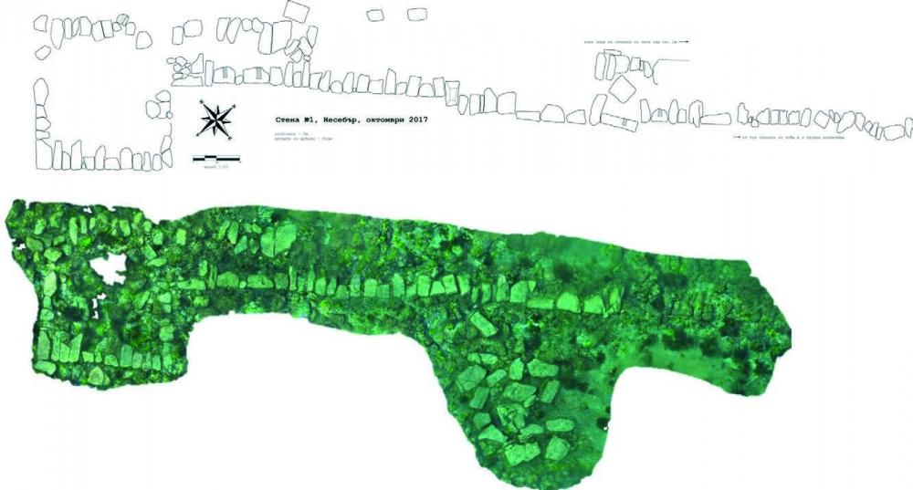
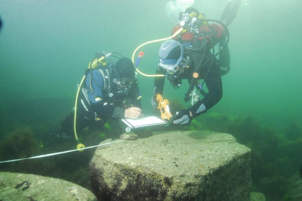
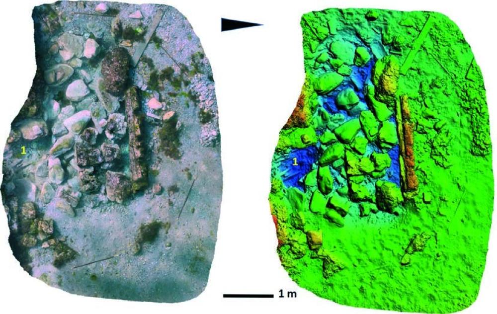
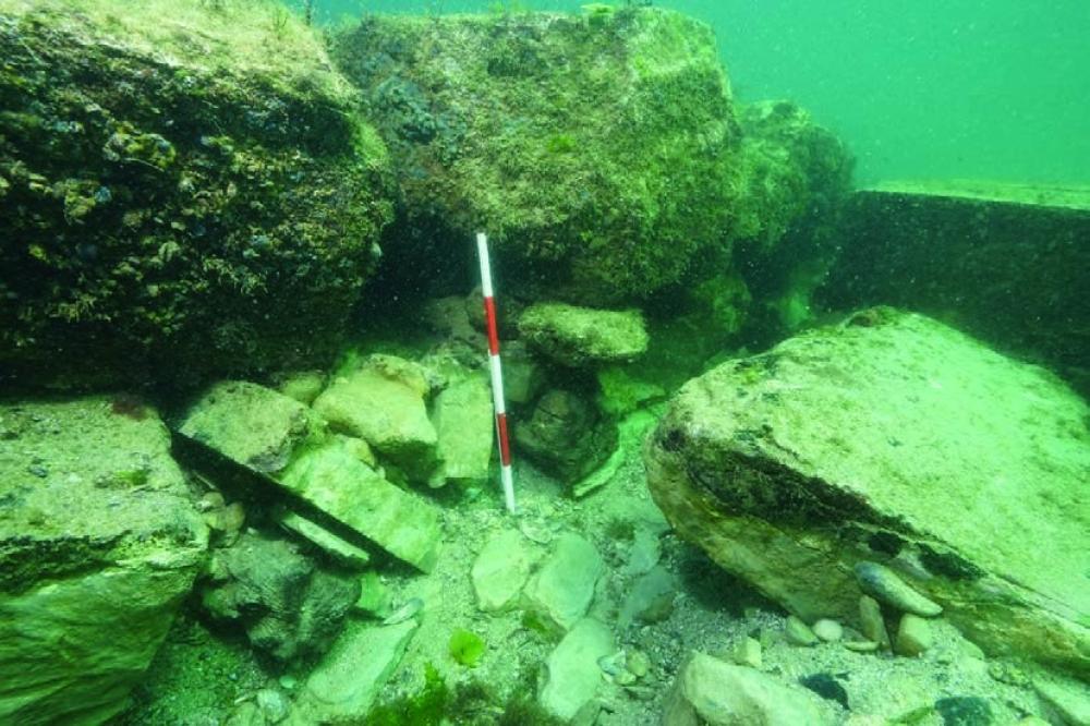
- UNDERWATER ARCHAEOLOGICAL EXPLORATIONS IN THE AQUATORY OF MESAMBRIA (Nayden Prahov – naydenprahov@yahoo.com, Kalin Dimitrov) During underwater diving surveys in the southern gulf of the peninsula, sectors of the early Byzantine fortification wall were disc... Read More
- UNDERWATER ARCHAEOLOGICAL EXPLORATIONS OF MESAMBRIA (Nayden Prahov – naydenprahov@yahoo.com, Kalin Dimitrov) In the bay to the west of the Southern Breakwater, a sondage was carried out at the foundation of the eastern sector of the Early Byzantine fortifi... Read More
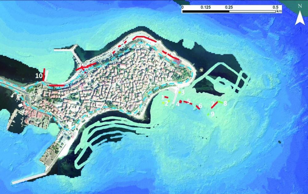
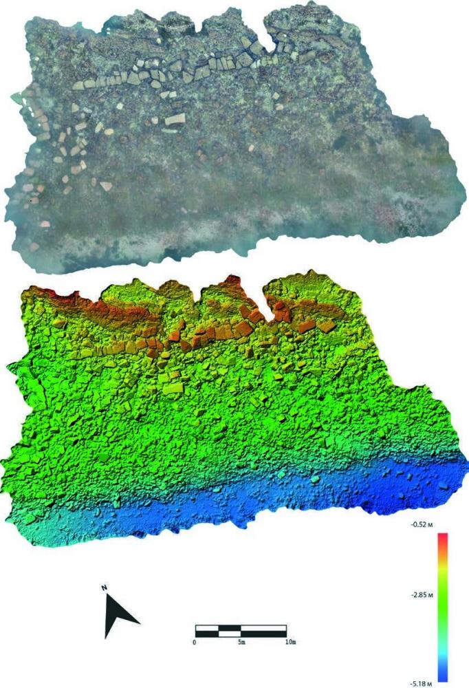
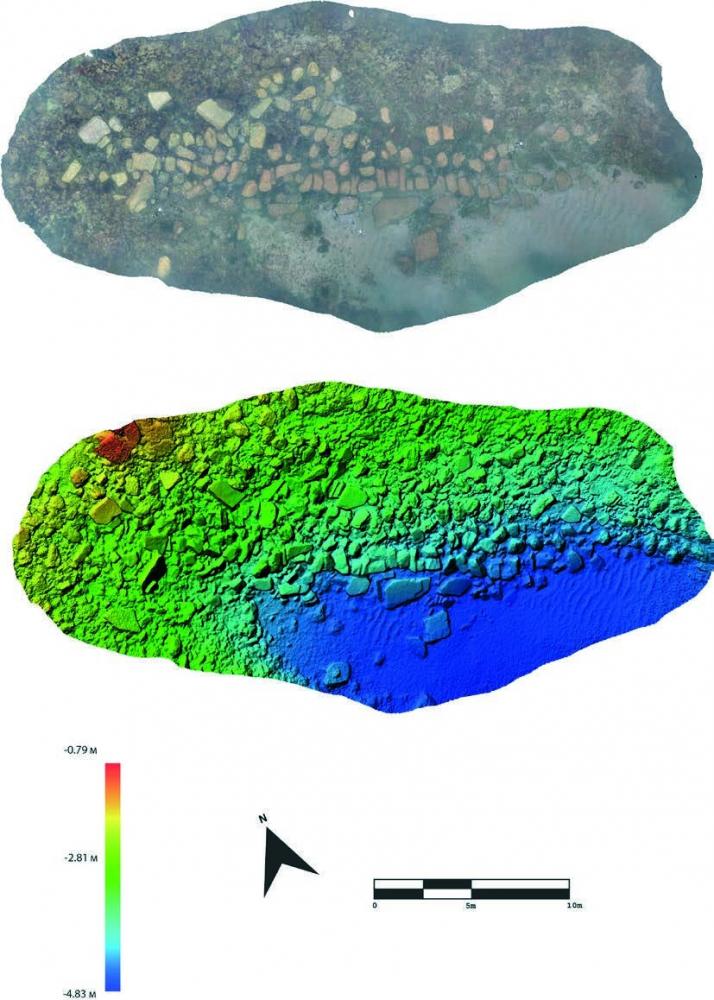
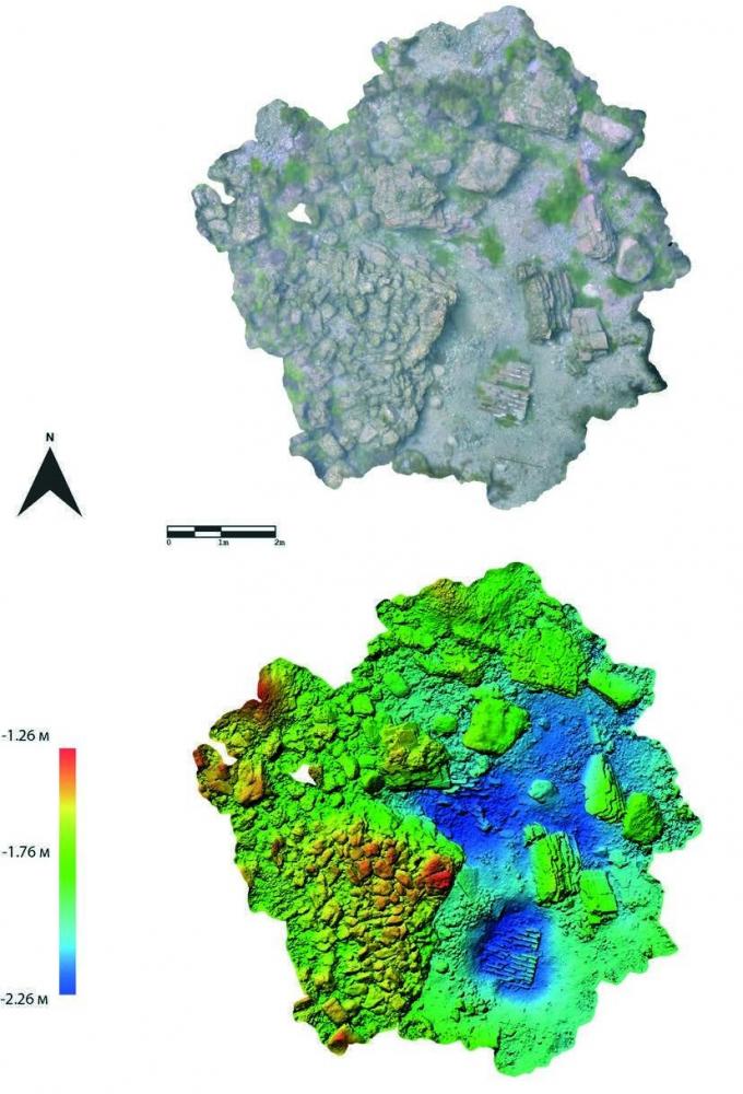
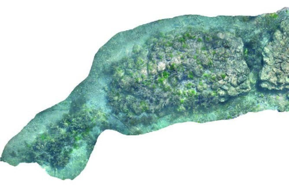
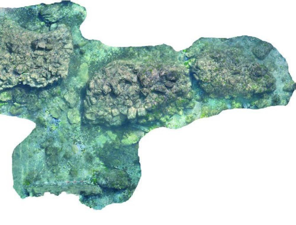
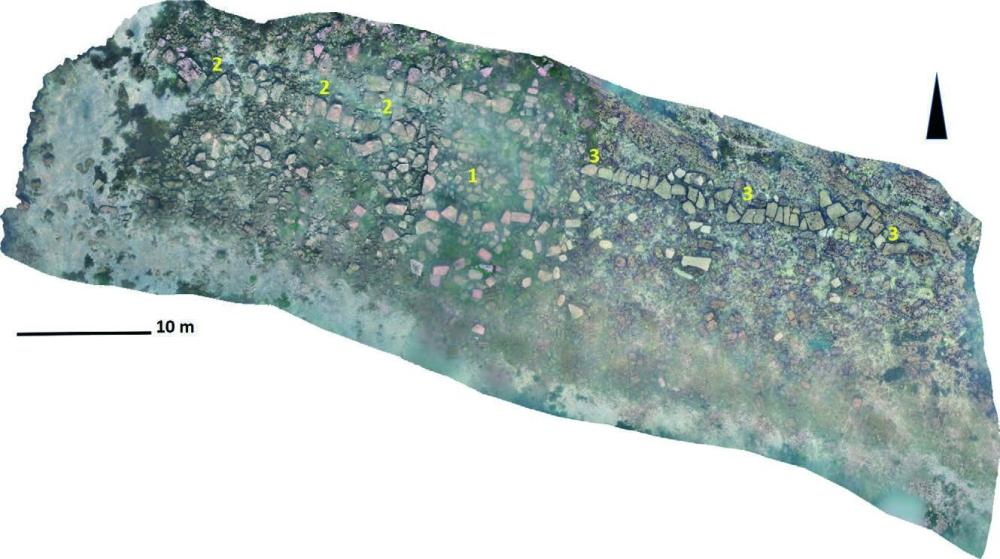
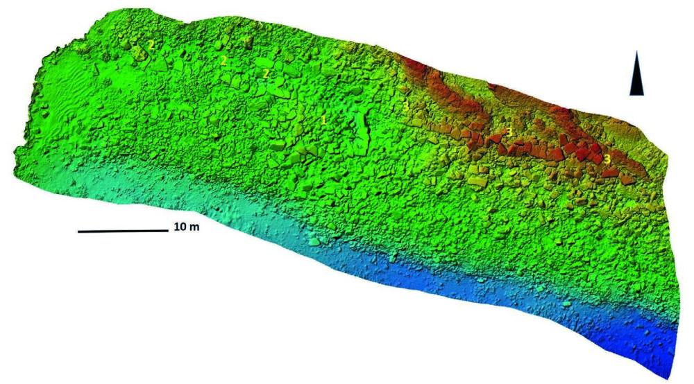
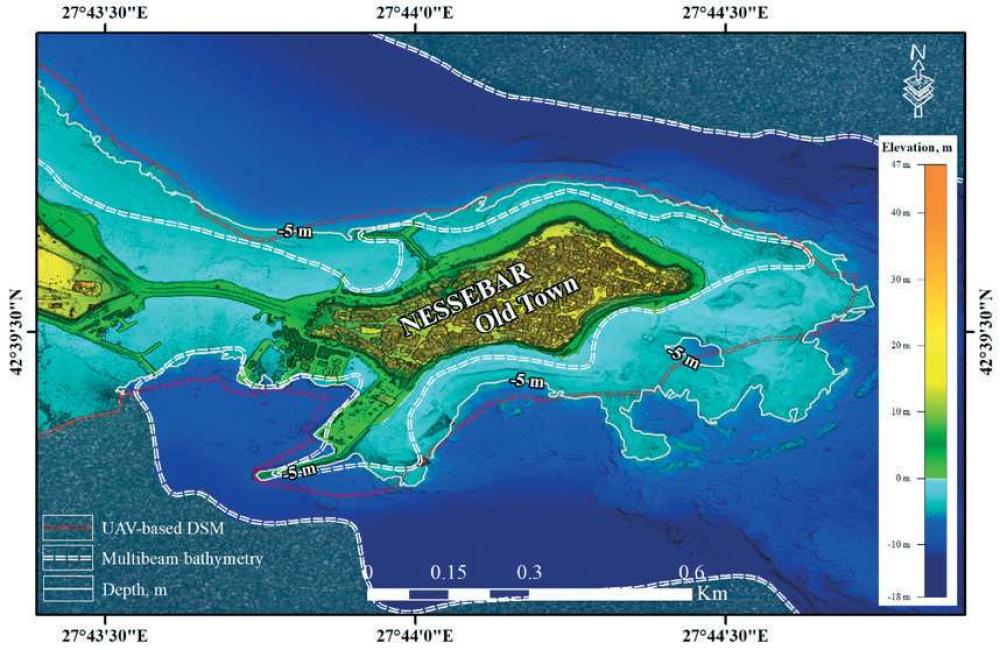
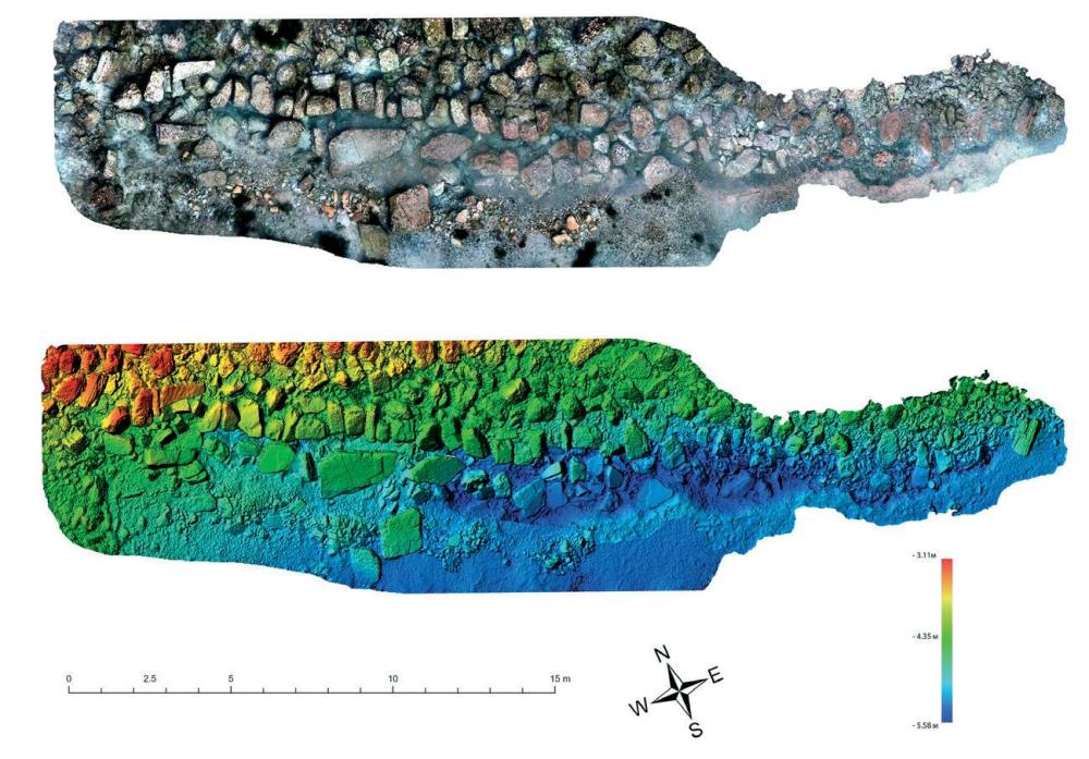
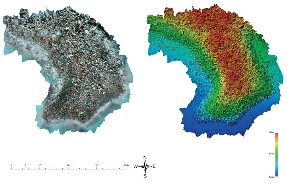
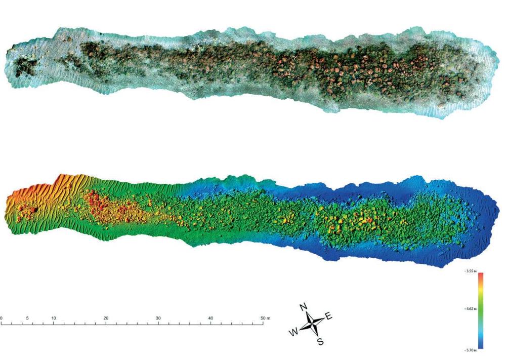
- UNDERWATER EXPLORATIONS AT MESAMBRIA (Nayden Prahov – naydenprahov@yahoo.com, Kalin Dimitrov) The peninsula and its water area were photographed with a drone. A digital terrain model was produced from the aerial photographs by means of photogrammetric proc... Read More
- 1000 BC
- 400 BC
- 0 AD
- 300 AD
- 600 AD
- 1000 AD
- 1400 AD
![[PDF]](download.php?file=10523.jpg "Download")
![[PDF]](download.php?file=10524.jpg "Download")
![[PDF]](download.php?file=10525.jpg "Download")
![[PDF]](download.php?file=10526.jpg "Download")
![[PDF]](download.php?file=10527.jpg "Download")
![[PDF]](download.php?file=10528.jpg "Download")
![[PDF]](download.php?file=10529.jpg "Download")
![[PDF]](download.php?file=12274.jpg "Download")
![[PDF]](download.php?file=12275.jpg "Download")
![[PDF]](download.php?file=12276.jpg "Download")
![[PDF]](download.php?file=13079.jpg "Download")
![[PDF]](download.php?file=13080.jpg "Download")
![[PDF]](download.php?file=13081.jpg "Download")
![[PDF]](download.php?file=13082.jpg "Download")
![[PDF]](download.php?file=13083.jpg "Download")
![[PDF]](download.php?file=13084.jpg "Download")
![[PDF]](download.php?file=15340.jpg "Download")
![[PDF]](download.php?file=15341.jpg "Download")
![[PDF]](download.php?file=15342.jpg "Download")
![[PDF]](download.php?file=15343.jpg "Download")