


Summary (English)
The excavation of the settlement of Timpone della Motta undertaken by the University of Calabria explored the so-called “pianoro II”, where previous Dutch excavations led by Marianne Kleibrink had identified residential structures. The following is a preliminary report as the finds have yet to be studied.
The excavation was preceded by an analysis of the plateau using a drone and geophysical survey. A field survey was also carried out, which documented the finds and structures across all areas of the plateau and showed that, at least in the archaic period, the settlement was densely occupied. Most of the finds recovered dated to this period, but other survey finds also dated to the Iron Age and the 4th century B.C.
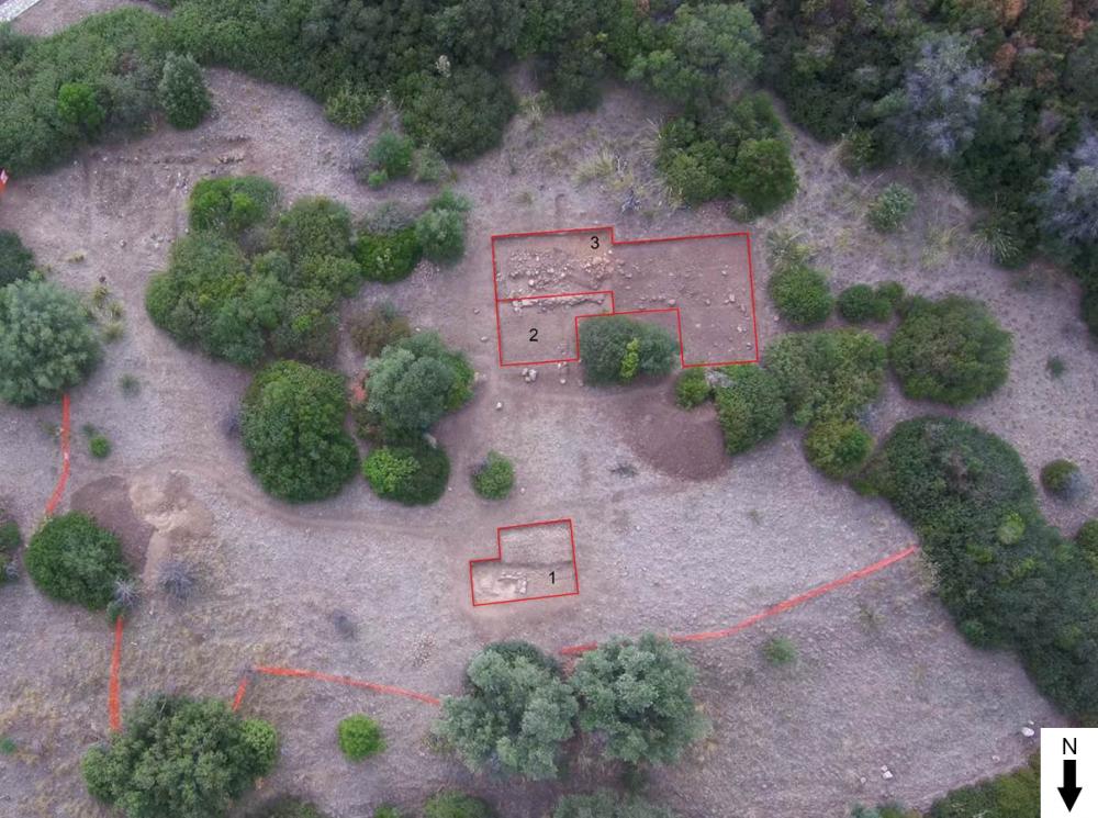
Three trenches, 5 × 5 m, 8.5 × 5 m and 8.5 × 4.0 m, were opened and later extended to cover a total of 168 m2. Natural was only reached in trench 1; the other trenches remain to be completed.Trench 1: the remains of a house built of cobblestones were identified, including traces of housings in the bedrock. Over the course of time, the structure had suffered heavy erosion and robbing and was then obliterated by layers containing abundant pottery. The building was situated along one end of a rock outcrop, which was levelled by a cut and perhaps used as a surface on an east-west alignment.
Trench 2: a wall on an east-west alignment was identified, at present visible for 6.35 m, built of squared blocks of conglomerate and large cobblestones (0.40 m wide). The size of the blocks and construction technique differing from that of the houses already known on the plateau, suggest the wall must have been part of a rather large building. At present, the perimeter of the building has not been defined as the excavation remains to be extended and completed.
Trench 3: opened on the south side of Trench 2. A dense area of large cobblestones and lumps of conglomerate mixed with earth was identified. It was a maximum of c. 7 m long (east-west) and c. 1.50 m wide and was probably a retaining wall whose alignment was the same as the blocks in Trench 2. However, more excavation is necessary in order to define its function and chronology.
- Paolo Brocato - Università della Calabria
- Luciano Altomare - Università della Calabria
Director
Team
Research Body
- Università della Calabria - Dipartimento di Studi Umanistici
![[PDF]](download.php?file=5947.jpg "Download")