


Summary (English)
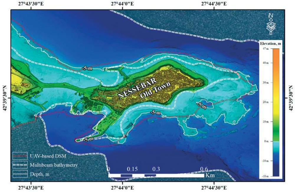
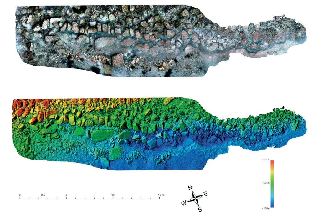
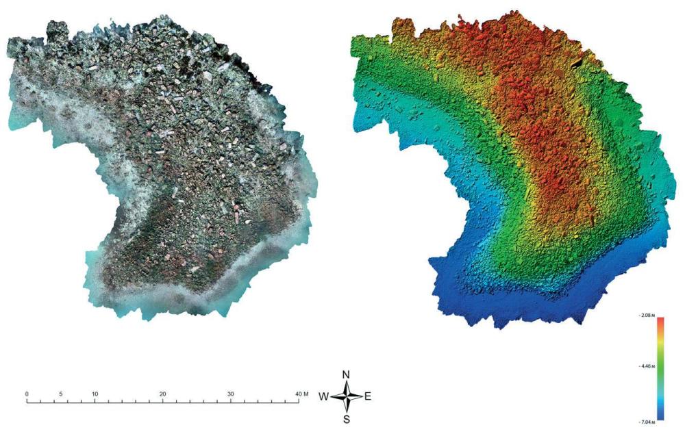
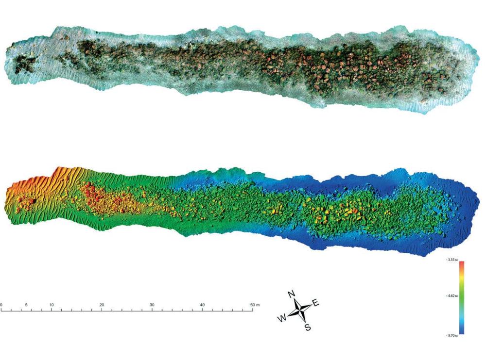
UNDERWATER EXPLORATIONS AT MESAMBRIA (Nayden Prahov – naydenprahov@yahoo.com, Kalin Dimitrov) The peninsula and its water area were photographed with a drone. A digital terrain model was produced from the aerial photographs by means of photogrammetric processing. The photogrammetric and echo sounder digital terrain models were combined, thus obtaining a unified digital terrain model of the peninsula and its water area up to -18 m in depth. Diving surveys were carried out to the south of the Marine Station. A structure of ashlars with a visible size of 2.50 m by 6 m was discovered at c. 5 m from the coast and at c. 50 cm in depth. It was probably the foundation of a fortification wall. During diving surveys in the bay to the west of the Southern Breakwater, sectors of the Byzantine fortification wall and a drum of a column were discovered; thus the drums of columns discovered so far became three. Two ancient breakwaters were explored to the east of the Southern Breakwater. The first one had an L-shaped layout and was built of piled stones, including spolia: ashlars, some of them with grooves for iron clamps, two fragmentary and one intact drum of columns. The breakwater was c. 45 m long, c. 25 m wide and c. 3 m high. The second breakwater was built of piled stones. It was c. 82 m long, 8 – 15 m wide and c. 1.50 m high. A Late Antique structure was noticed at its foundation, thus giving a terminus ante quem for the construction of the breakwater. The two breakwaters were documented photogrammetrically, and detailed terrain models and an orthophotomosaic were produced. The structures were photographed with a multibeam echo sounder and a bathymetric terrain model was produced.
- Nayden Prahov - Archaeological Institute with Museum
- Kalin Dimitrov - Centre for Underwater Archaeology
Director
- Kalin Dimitrov - Centre for Underwater Archaeology
- Nayden Prahov - Archaeological Institute with Museum
Team
Research Body
- Archaeological Institute with Museum
- Centre for Underwater Archaeology
![[PDF]](download.php?file=15344.jpg "Download")
![[PDF]](download.php?file=15345.jpg "Download")
![[PDF]](download.php?file=15346.jpg "Download")
![[PDF]](download.php?file=15347.jpg "Download")