


Summary (English)
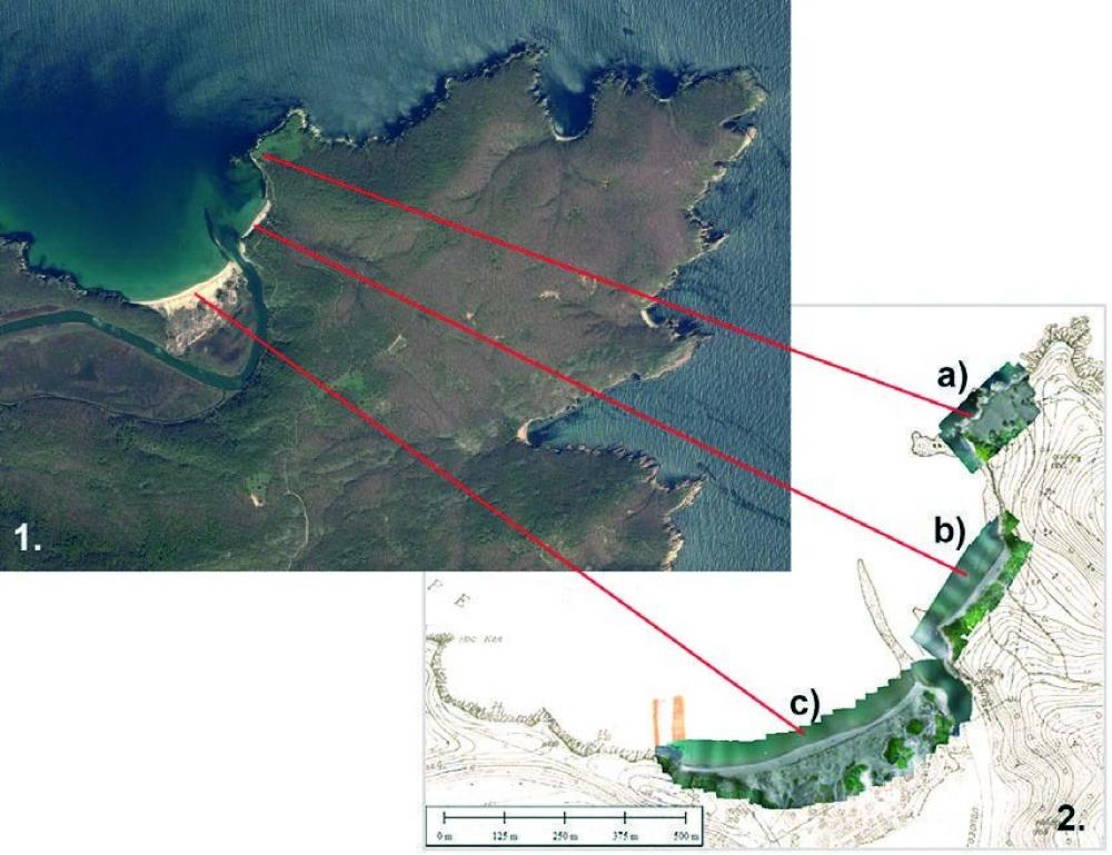
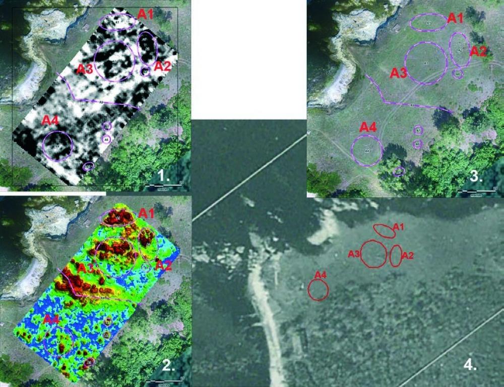
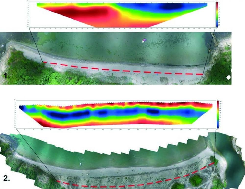
EXPLORATIONS NEAR THE MOUTH OF THE RIVER OF ROPOTAMO (Kalin Dimitrov – kalin.d@abv.bg, Daniel Pantov) Geophysical surveys were carried out in the area of St. Demetrius (Skombolito) Cape and the mouth of the River of Ropotamo. A drone survey with recording was also carried out to make orthophoto mosaics and create a DEM by aerial photogrammetry. During a field survey, rock-cut structures, probably cisterns, and a stratum with sherds were documented on St. Demetrius Cape. The maps obtained from geomagnetic and LiDAR measurements indicated areas with anomalies, including remains from rectangular buildings.
- Kalin Dimitrov - Centre for Underwater Archaeology
- Daniel Pantov - Museum of History – Primorsko
Director
- Daniel Pantov - Museum of History – Primorsko
- Kalin Dimitrov - Centre for Underwater Archaeology
Team
Research Body
- Centre for Underwater Archaeology
- Museum of History – Primorsko
![[PDF]](download.php?file=12368.jpg "Download")
![[PDF]](download.php?file=12369.jpg "Download")
![[PDF]](download.php?file=12370.jpg "Download")