Summary (English)
The Etrusco-Samnite settlement of Pontecagnano is known for its vast necropolises (c. 10,000 tombs), which illustrate the settlement’s development from its foundation, in the early 9th century B.C., until its destruction in the 3rd century B.C. when the Ager Picentinus became part of Rome’s territory.
The best-known parts of the settlement itself are the two sanctuary areas on the eastern side, both founded in the early 6th century B.C. The Via Verdi sanctuary, dedicated to Apollo, is situated in an open space, which was probably the city piazza, therefore identifying it as the city’s “polyadic” sanctuary. The second sacred area, situated just outside the city, was dedicated to a divinity whose name (_Luas_) is mentioned in an inscription on an Etruscan vase.
In the central area of the city, the best evidence is for the Roman phase of Picentia, when the city contracted along the so-called “decumanus”, which represents the urban section of the Regio-Capuam consular road, crossed by at least one orthogonal road (“cardo”). The only insula to be extensively excavated revealed residential buildings and production and/or commercial structures overlying in a complex stratigraphy that dates from the 2nd century B.C. to the 5th-6th century A.D. Further information was added to this picture between 2003 and 2006 by the investigations undertaken during the widening of the Salerno-Reggio Calabria motorway that crosses a peripheral area of the settlement. The excavations, undertaken by the University of Salerno and the “Orientale” University of Naples, intercepted a section of the fortifications and a sequence of roads that were equidistant and on the same alignment, which attest an extensive reorganisation of the settlement in the late-archaic period. This foresaw a road system per strigas, with 46 m insulae separated by roads 5.5 m wide on a north-east/south-west alignment and divided longitudinally in two rows of residential lots. This urban layout remained in use in the settlement’s Samnite phase until its destruction in about the mid 3rd century B.C.
Since 2010, the University of Molise in collaboration with the department of Etruscan Studies at the University of Salerno has been excavating in the area of the archaeological park. The objective is to explore the extension of the late-archaic structures also in the central part of the city. In 2015, the department of Etruscan Studies at the University of Salerno carried out excavations.
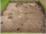
Overall, the excavations have uncovered a road on a north-east/south-west alignment that re-traces the line of the so-called “cardo” and is also on the same alignment as the roads of the 5th-6th century urban plan. The latest roadbed, constituted by a loose layer of rubble (stones, brick/tile fragments, and pottery) can be dated to the late 3rd and the 2nd centuries B.C., and probably represents the continuation of a pre-Roman road. In fact, it overlies at least four earlier road levels, along which stood buildings dating to the 4th century B.C. phase, one of which extensively investigated by the University of Molise.
Based on this data, which will be checked during the next campaigns, it appears that, at least in part, the late Republican road network (2nd century B.C.) re-traces the Etrusco-Samnite one. A trench dug in order to trace a second road situated at the modular distance of 46 m also confirmed this. In the trench, the 5th and 4th century B.C. levels had been removed by two large parallel ditches, aligned north-west/south-east, datable to the late Republican phase. The fill covered the wall of a building that just appeared in the south-east end of the trench and was on the same alignment as the urban layout and positioned according to the modular distance of the pre-Roman period (c. 51.50 m 0 46 + 5.50 m of the road).
- Carmine Pellegrino - Dipartimento di Scienze del Patrimonio Culturale – Università di Salerno
Director
- Angela Iacoe - Soprintendenza Archeologia della Campania
Team
- Anna Rita Russo- Università di Salerno
- Valeria Petta - Dipartimento di Scienze del Patrimonio Culturale – Università di Salerno
- Antonella Massanova - Dipartimento di Scienze del Patrimonio Culturale – Università di Salerno
Research Body
- Università degli Studi di Salerno


![Download [PDF]](/excavation/skins/fasti/images/results/download_sml.png)